Tobermacduagh, Tobar Mac Duagh or Duach, Kinallia


Townland: Kinallia, Keelhilla, Carran
Kinallia or Cinn Allia, meaning ‘The Point of the Cliffs’
Kellhilla or Caelchoille, meaning ‘The Narrow Wood’
Description of Holy Well and Landscape Setting
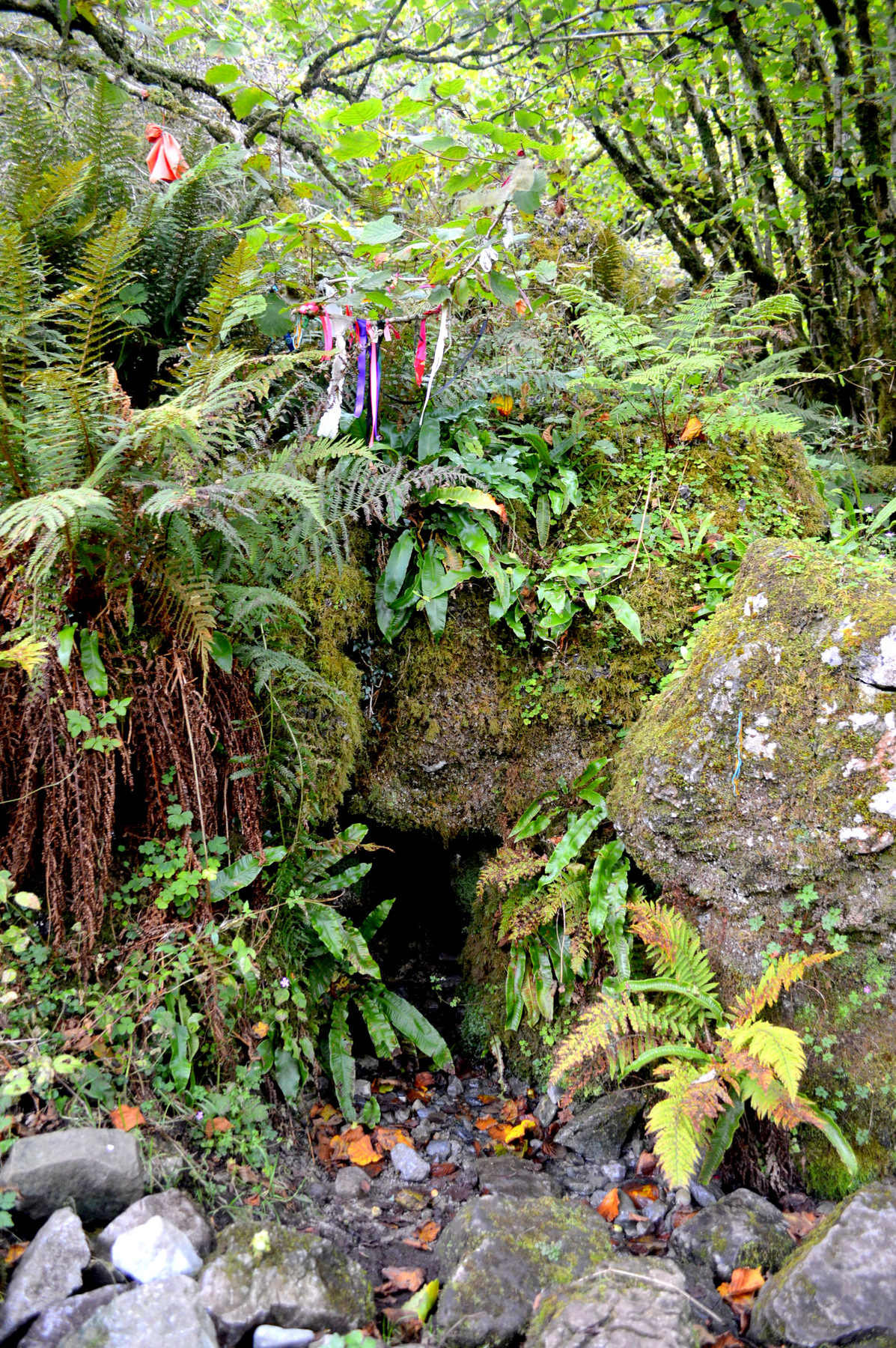
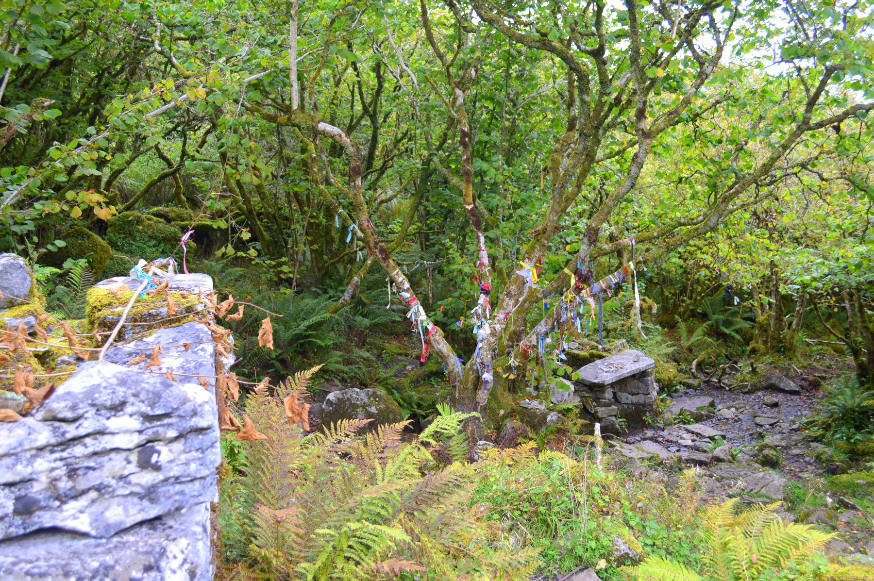
The well is located in a sheltered grove of trees at the base of Eagle Rock Mountain, in the Burren National Park. The well site can be found by travelling through the gates of the Burren National Park and heading towards the northwest corner of the hill in front, almost to the base of the cliffs. An established path leads to the well.
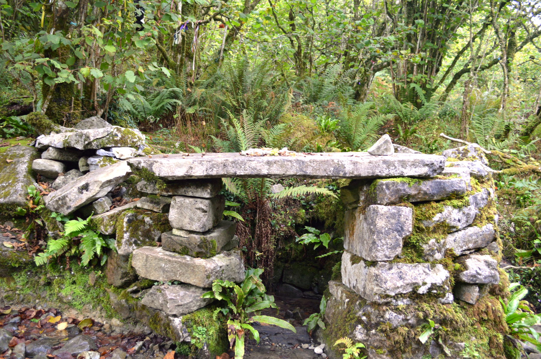
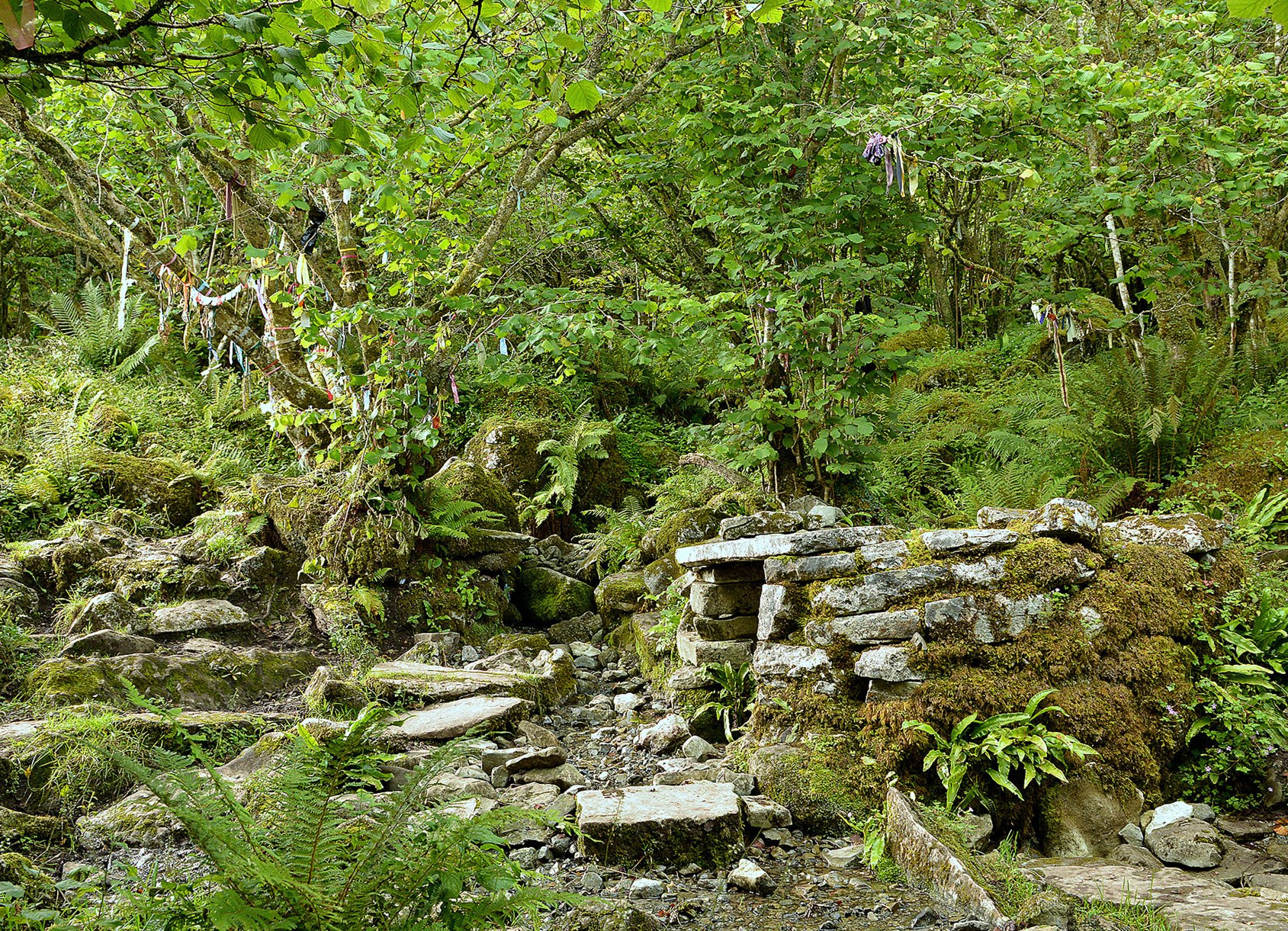
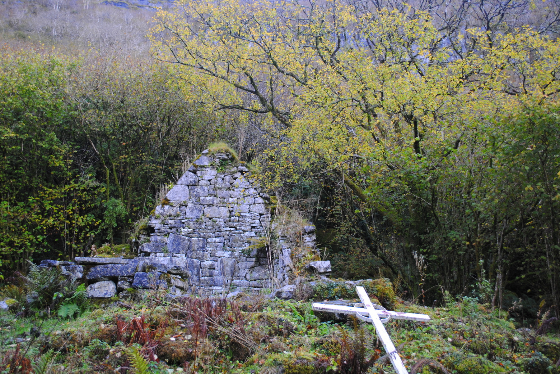
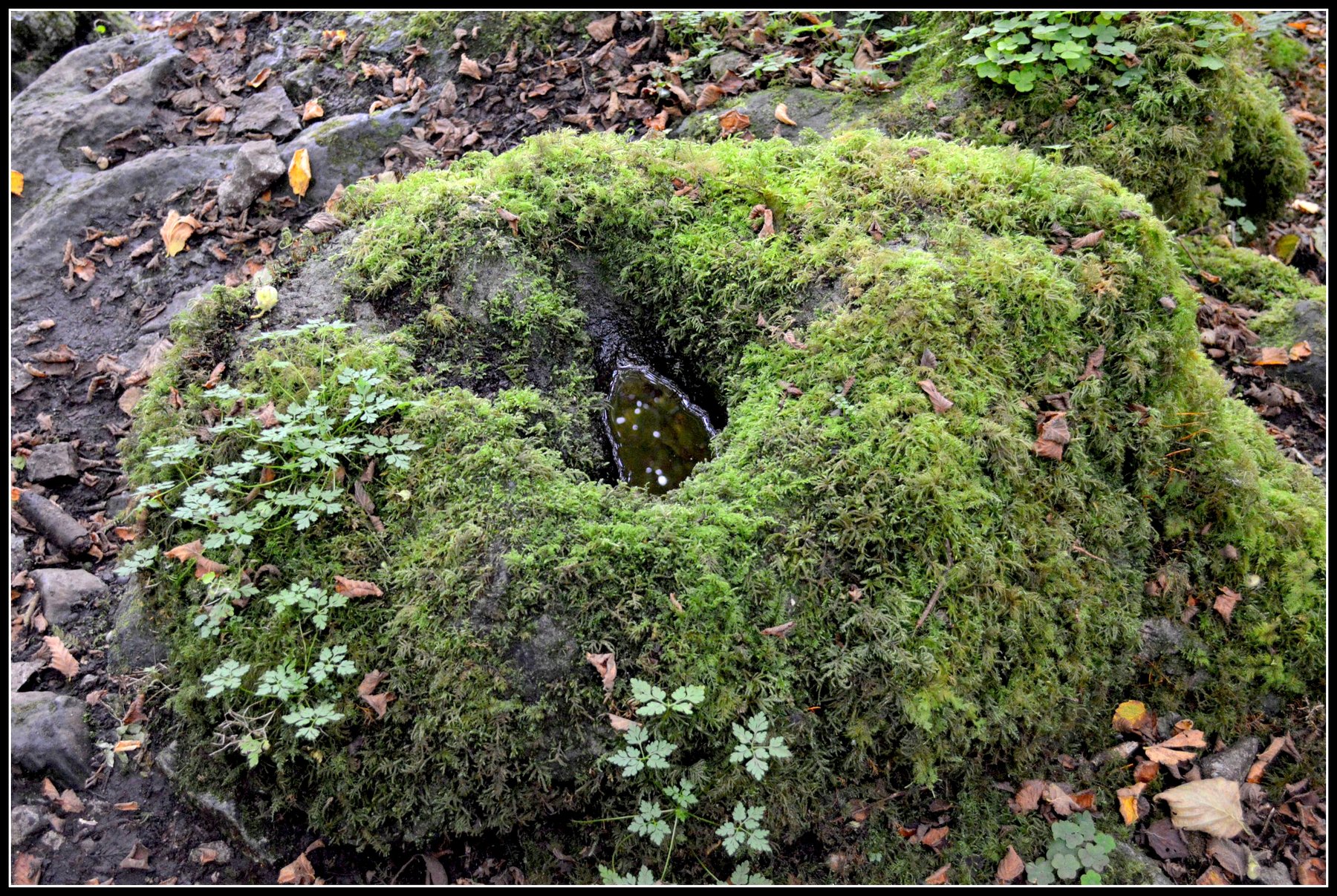
At the same site are the remains of a medieval oratory, possibly dating to the 11th or 12th century. There are two penitential altars or ‘leachtanna’, which may have been created from the stones once used in the construction of the oratory. There is also a bullaun stone, a stone with a basin like depression, as well as the holy well.
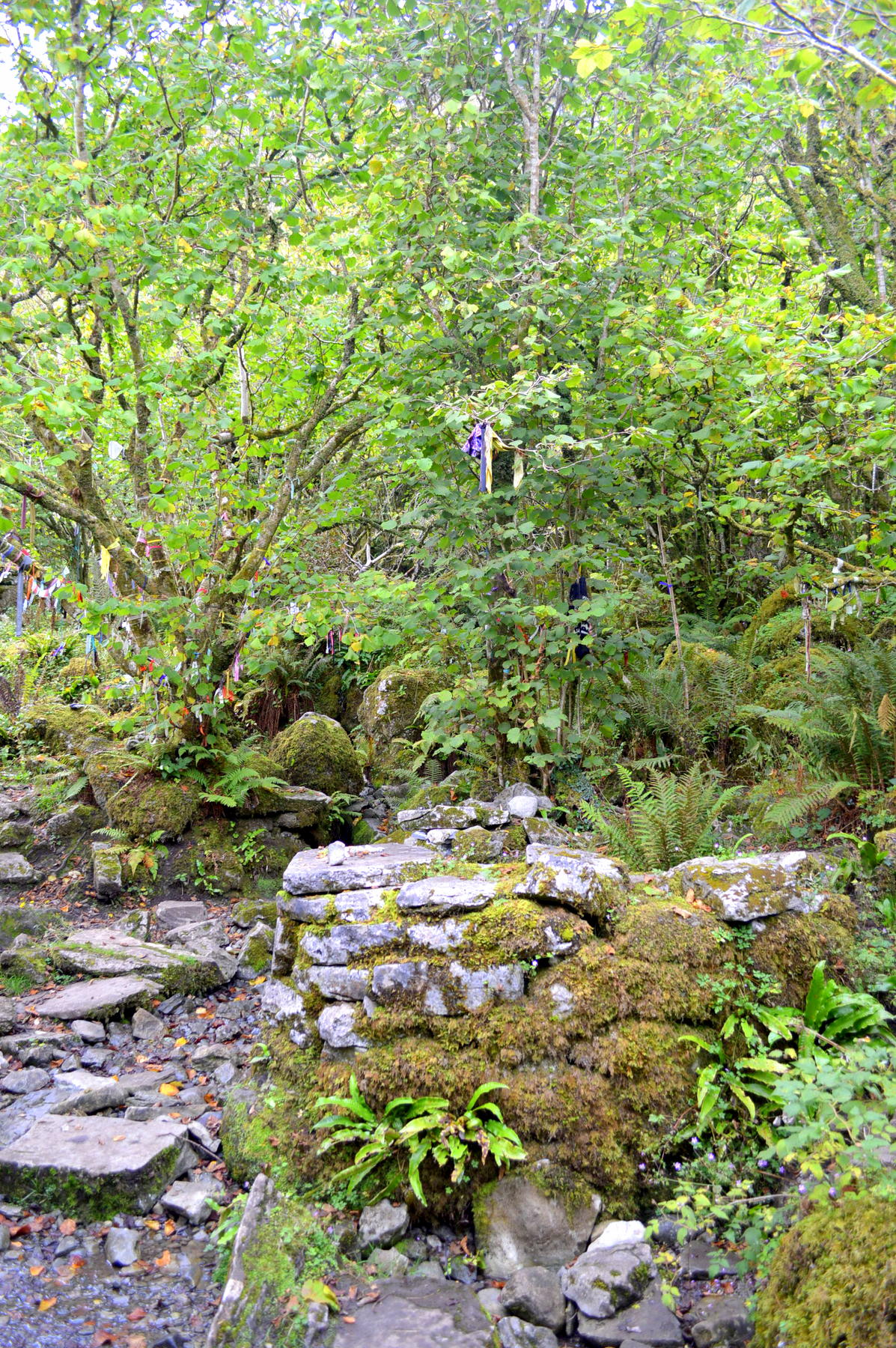
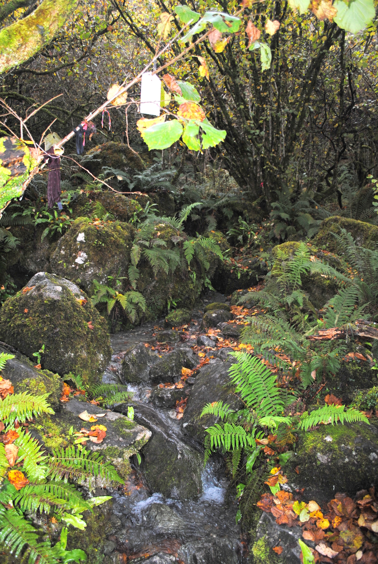
The well is supplied by crystal clear water emerging between rocks a little higher up. There is a rag tree or ‘clootie tree’ of recent origin nearby. There are tall cliffs behind the site. At the rear of the site and slightly higher is a tiny cave in which Saint Mac Duagh meditated. It is overall the quintessential early medieval eremitic site. The area is rich in both story and archaeology. To the east of the well is another monument known as The Servant’s Grave.
Saint and Feast Day Associated with Holy Well
3rd February has been suggested as the feast day at this holy well, but Saint Colman’s feast day is celebrated in the area on 29th October. One historical record from 1839 lists the pattern day at the well as falling on ‘the last Sunday of summer‘.
(See Additional Information section below)
There are two kinds of visitation at this holy well. Firstly, the current generation of locals who have always made a pilgrimage to the well. The second type of visitor are those who see the signs in the National Park, or who are taken to the site as part of a guided tour. It is this second set of visitors who have created the ‘clootie’ tree, on which a large variety of offerings can be found, including face masks, stuffed toys and money notes.
Natural Heritage around the Holy Well
The site is covered in ash trees that have provided shelter at the holy well for generations. The shelter provided by these trees has resulted in a wonderful carpet of wild garlic, ferns and bluebells in the undergrowth in spring. Some of the trees have been removed in recent years.
Heritage Attractions Nearby
The holy well site lies in the heart of the Burren Region and the Burren National Park – an area full of archaeology, history, geology and fascinating botany.
Additional Information
Descriptive Remarks, Ordnance Survey Parish Namebook, 1839:
‘Tubbermacdooagh Holy well situated here at which stations are performed by the peasantry and a patron held here on the last sunday of summer’
Discover More…
Record from Ordnance Survey Parish Namebook, 1839 on Logainm.ie
Houlihan, M 2015, The Holy Wells of County Clare
Record of Monuments and Places Number
RMP-CL006-02305
Surveyed by Michael Houlihan


No Comments
Add a comment about this page