
Townland: Poulacapple, Rathborney
Poulacapple comes from the Irish ‘Poll an Chapaill’, meaning ‘The Horse’s Cave’.
Rathborney comes from the Irish ‘Ráth Bhoirne’ meaning ‘Burren Fort’, in honour of an earthen ringfort within which the monastic site of Rathborney sits.
Description of Holy Well and Landscape Setting
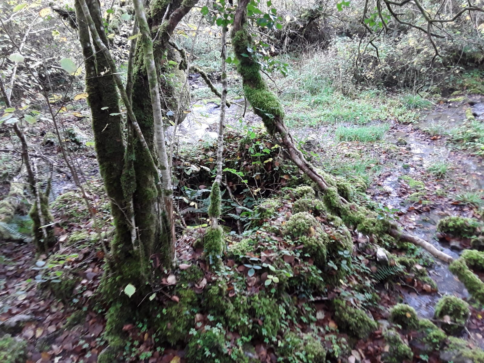
The holy well was once located on an area of limestone pavement and thin soil. However, with the decline of traditional hill farming in the last few decades, this limestone pavement has been overtaken by scrub and the area where the well sits is now woodland. The well is fed by a spring. Some of the water that flows from this spring is housed in the well house, a circular drystone structure. A small facsimile high cross lies in the water of the well, as well as some shards of crockery. These offerings appear to have been left at the well in recent times. There are immature hazel trees overhanging the well.
The area is known locally as Saint John’s Grove.
The holy well lies near an area of very good farmland in the Rathborney Valley. The land here is made up of glacial drift over bedrock. The townland boundary wall is only a few metres west of the well and the townland of Faunarooska lies over this wall. Rathborney River is 0.5 kilometres east and further east again is the Rathborney monastic site, about 1.5 kilometres from the well.
Saint and Feast Day Associated with the Holy Well
This well is dedicated to Saint John the Baptist, an international saint. It is possible that the well was originally dedicated to a local saint and this dedication was replaced during the devotional revolution which took place in the 19th century in Ireland. However, there is no evidence of any other saint being associated with this holy well.
The Ordnance Survey Letters record in the 1830s that:
‘It would appear from a Holy Well situated in the Townland of Poulnagapple, near a mile to the northwest of this Church, that it was dedicated to St. John. No ancient Irish Milesian Saint is remembered in connection with it or with any locality in the Parish’
Natural Heritage around the Holy Well
The well is set in maturing hazel woodland with a rich mix of primitive plants including ferns, mosses, liverworts and lichens.
Heritage Attractions Nearby
An ancient church and burial grounds are located at Rathborney, 1.5 kilometres east of the well. This site is managed by the Office of Public Works. Ballyvaughan Village is 4 kilometres north-east of the well.
Discover More…
Ordnance Survey Letters, Royal Irish Academy
Ordnance Survey Letters, Ask About Ireland
Record of Monument and Places Number
RMP CL 005 – 014006.


No Comments
Add a comment about this page