Tobergeeraun, Fanore More


Townland: Fanore More, Killonaghan
Fanore More from the Irish ‘Fán Óir Mór’ meaning ‘The Big Declivity by the Sea Coast’.
Killonaghan, anglicised from ‘Cill Onchon’. Meaning the ‘Church of Onchu’. Saint Onchu, (in the genitive Onchon), was the son of Saint Blathmac of Rath.
Description of Holy Well and Landscape Setting
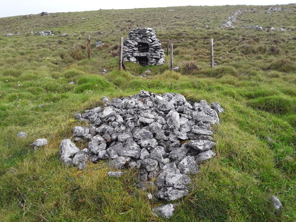
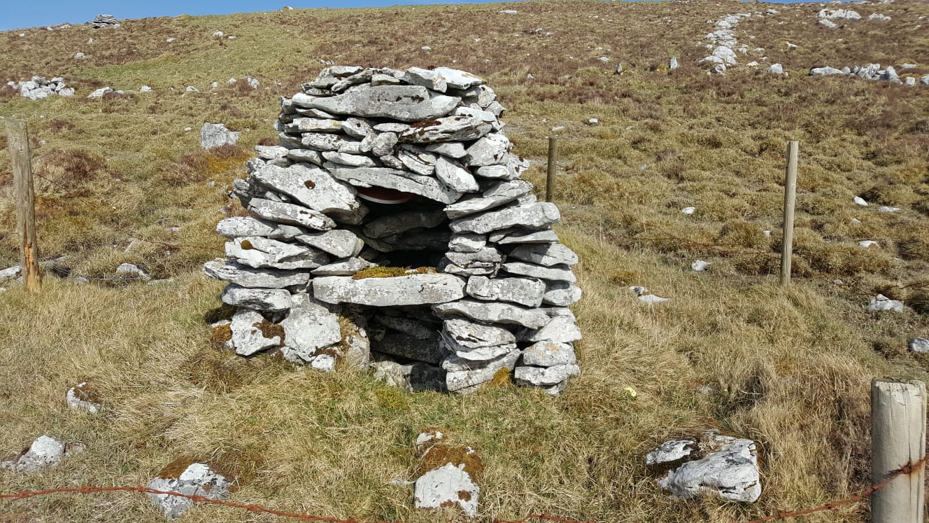
This holy well is located in between the limestone pavement and the Fanore Valley, an area of glacial drift over bedrock. It is a wetland area caused by surface water emerging. The source of the water is in the shale uplands of Slieve Elva (346m) to the south of the well. The well house is a drystone construction. A flagstone inserted into the fabric of well house overhangs the well and functions as an altar and area for offerings.
There is a dry stone penitential station or ritual monument a couple of metres from well. The Record of Monuments and Places Number for this station is RMP CL 004 – 019002. There is no record of the type ritual which took place at this station.
Saint and Feast Day Associated with Holy Well
‘Tober’ is an anglicisation of Tobar’, meaning well. ‘Geeraun’ is most likely an anglicisation of Ciarán. Given that Saint Ciaran has strong associations with the Aran Islands, which are very close to Fanore, this dedication would make sense. Details of the holy well are very scant. No written detail of the well has been found. Tobergeeraun is one of the very few holy wells not mapped by Tim Robinson in his highly detailed publication ‘The Burren: A Two-Inch Map of the Uplands of North-West Clare’
The only local information obtained was that coins were left as votive offerings at the well within living memory. These coins are no longer in evidence. There is one offering at the holy well, and this is a ‘concretion’, a spherically-shaped stone located on the altar over well. Some antiquarians, including T.J. Westropp, documented concretions like these as offerings at holy wells.
Natural Heritage around the Holy Well
Underground water making its way from Slieve Elva emerges overground for a short stretch at this site. Typical wetland plants are found here. The site enjoys lavish views of Galway Bay to the west.
Heritage Attractions Nearby
Fanore Village and Killonaghan Church are less than 2 kilometres west of the holy well. Sinéad Ní Gabhláin writes that the foundation of Killonaghan Church may be early Christian in origin. The ruins of Faunarooska Castleare 200 metres approximately south. The Burren Way, a long-distance marked walking trail is a couple of hundred metres uphill from well.
Additional Information
A large concentration of ring forts are located within a few hundred metres of the north of the well. Fanore More once had a large population. Approximately 70 people are recorded as living there in the 1901 census
Discover More…
Ní Gabhláin, S 1995, ‘Church, Parish and Polity: The Medieval Diocese of Kilfenora’, Dissertation in partial satisfaction for the degree Doctor of Philosophy in Archaeology. University of California, pp. 488-490
Ó Riain, P 2011, A Dictionary of Irish Saints, Four Courts Press Ltd, Dublin, Ireland
Robinson, T 1999, The Burren: A Two-Inch Map of the Uplands of North-West Clare, Folding Landscapes, Galway
Westropp, T.J. 1912, A Folklore Survey of County Clare, edited by Maureen Comber 2000, CLASP Press, Ennis
Record of Monument and Places Number
RMP- CL 004 – 019
Special Area of Conservation


No Comments
Add a comment about this page