Saint Tola's Well, Tobar Tola, Mollaneen


Townland: Mollaneen, Dysert O’Dea
Description of Holy Well and Landscape Setting
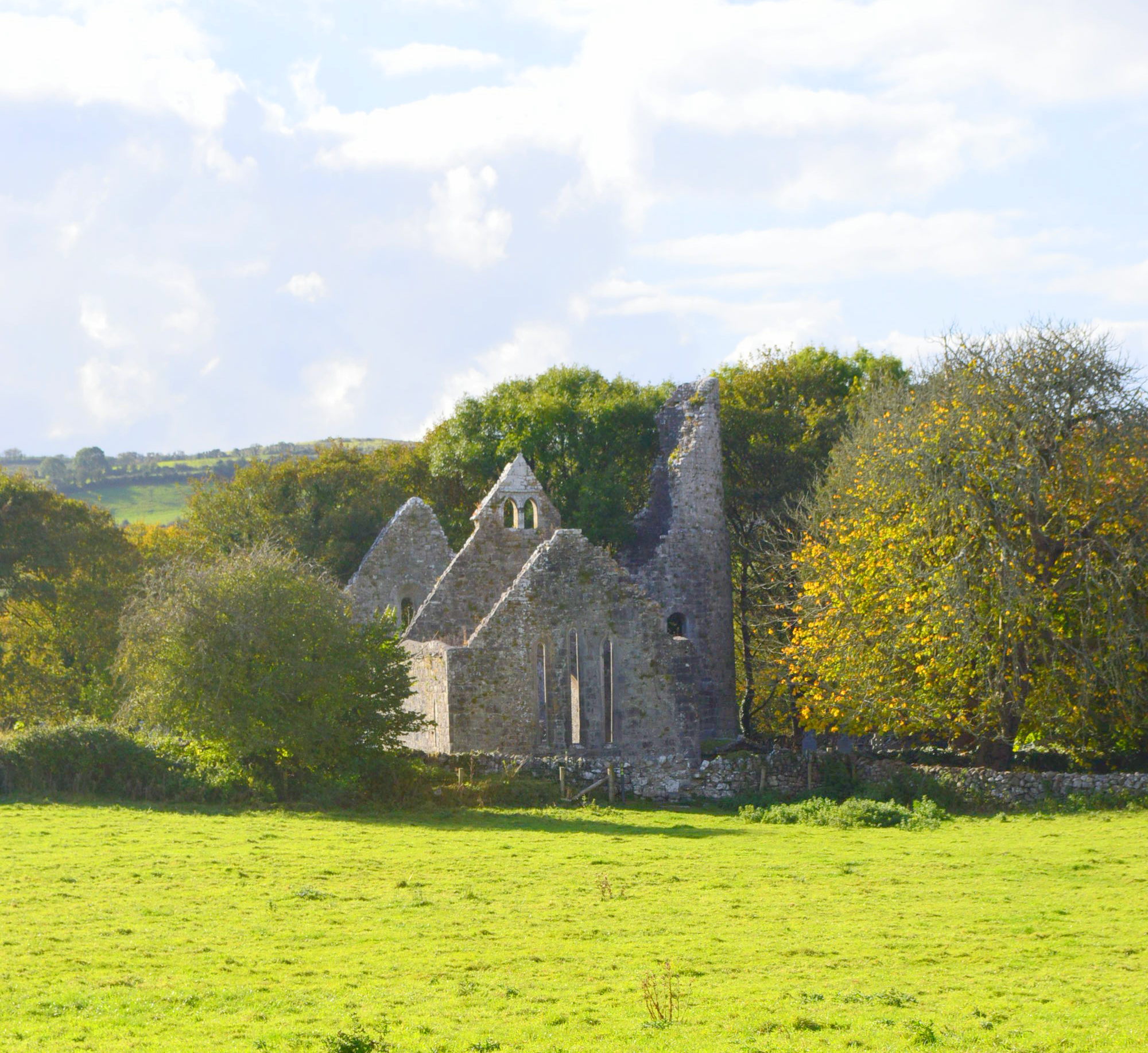
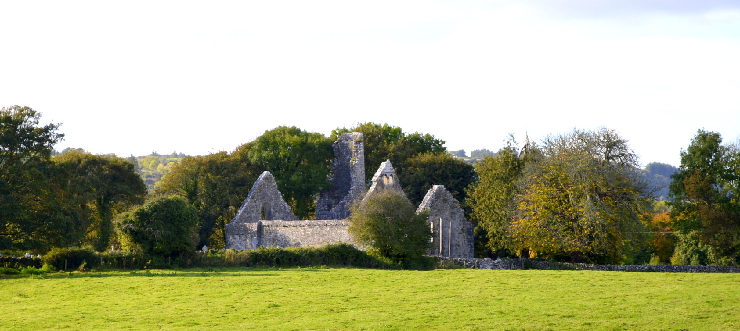
This holy well is located at the Dysert hermitage site. The well is tucked into the south-east corner, close to the road. The Dysert hermitage site consists of a selection of monuments, including a church with a Romanesque doorway of carved heads, both religious and fantastical.
Around the church is the graveyard, which is still in use and behind the church are the substantial remains of a round tower or ‘cloghas/clogás’. In the field to the east is Dysert High Cross. It has a large carving of a bishop and the crucified Christ above. The right arm of the cross is missing, and this may have been used as a socket type reliquary for a religious artefact, possibly a saint’s bone which would have been displayed on special days. Most of the structures on the site date to the 12th century.
Saint and Feast Day Associated with Holy Well
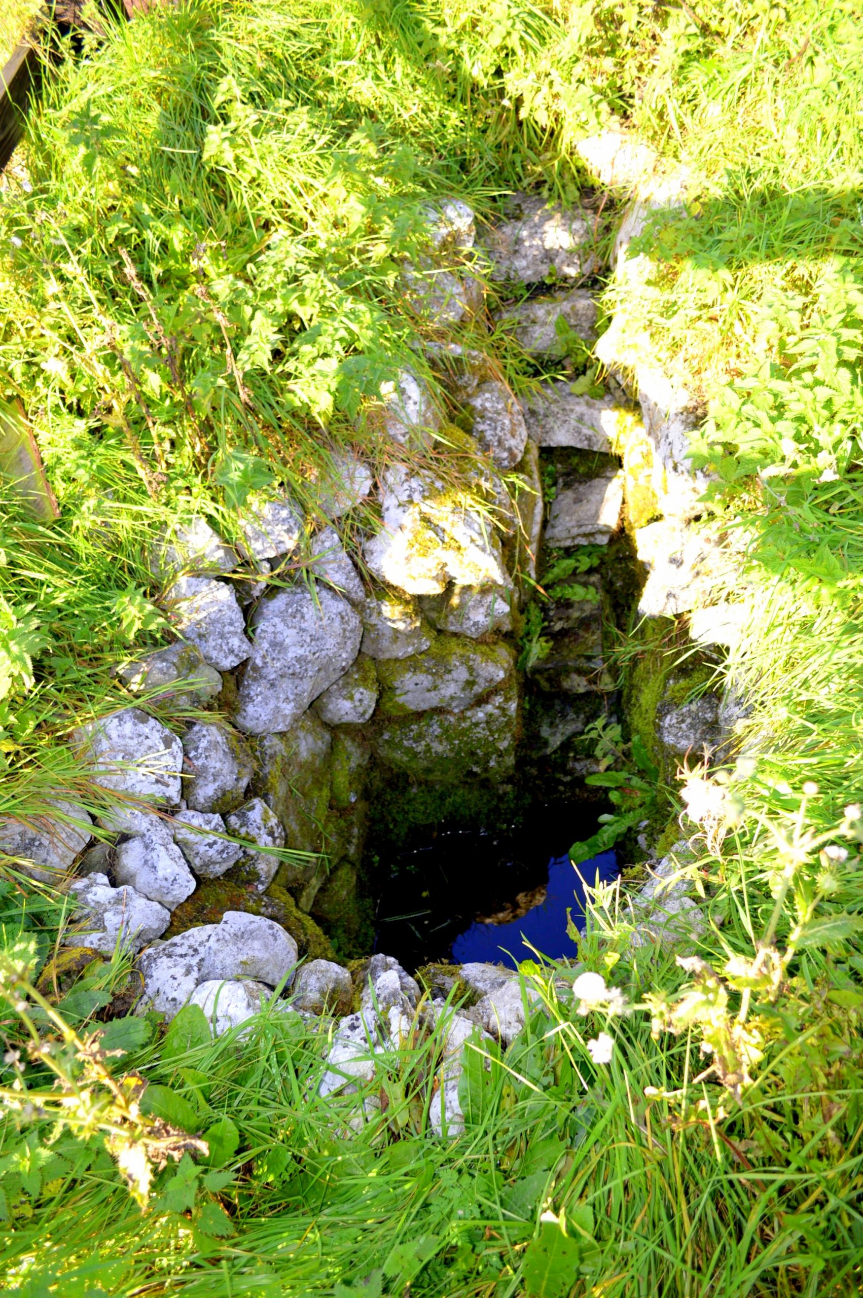
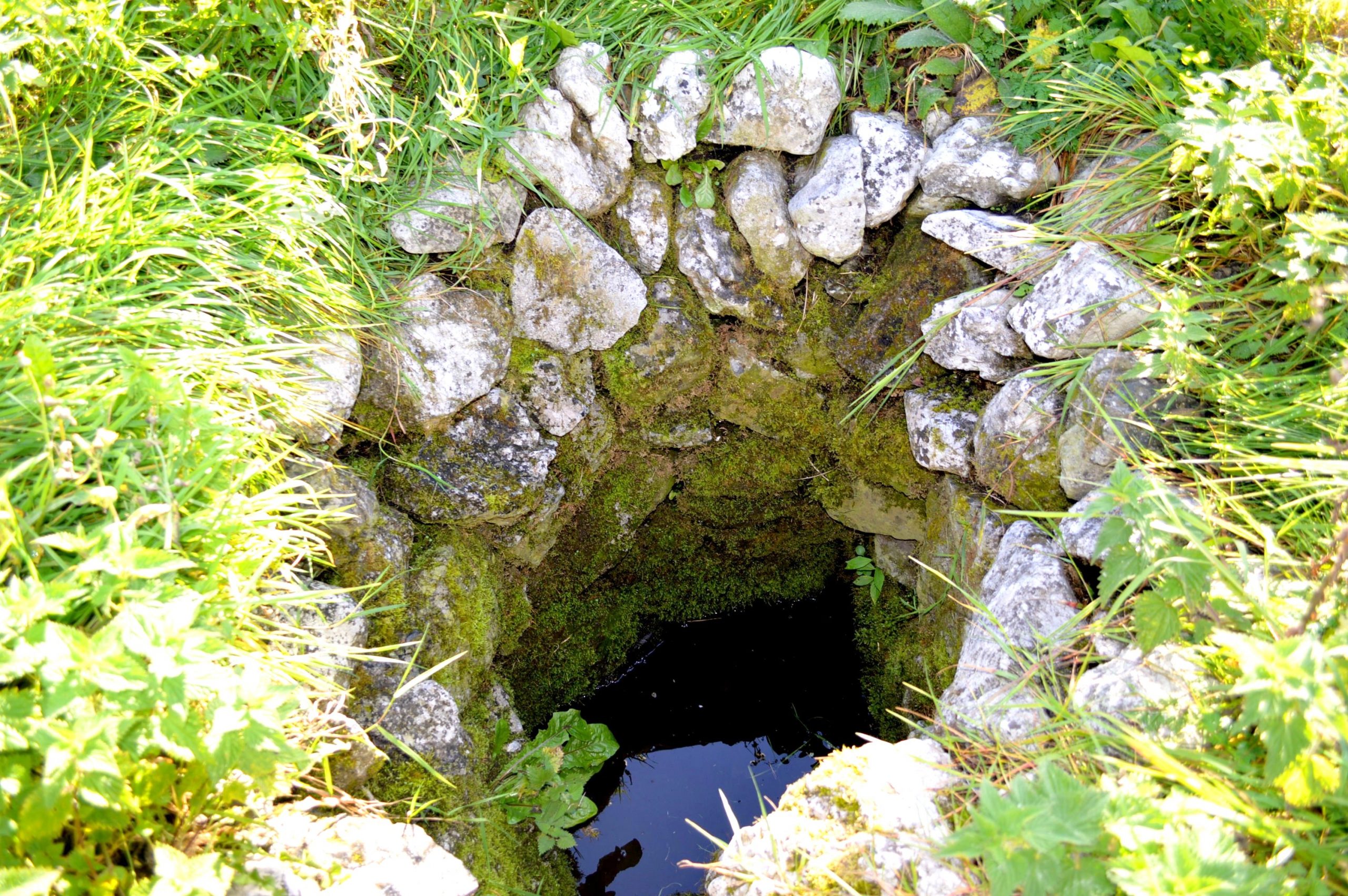
The site is dedicated to the eighth century Saint Tola Cráibhtheach (Tola the Pious). Saint Tola’s feast day is 30th March. The well is said to offer cures for eye ailments. The well, which takes the form of a spring, is stone-lined and set into the ground. The well area was overgrown at the time of the research visit. There was no evidence that the well has been visited as a religious site in recent times. No offerings were noted at the well.
Natural Heritage around the Holy Well
The area around the well is largely farmland, with intermittent trees growing around.
Heritage Attractions Nearby
The well stands in a rich archaeological complex of approximately 25 monuments. These are managed from the 15th century O’ Dea Castle on the site, which offers information of the area. Guided tours of the castle are also available.
See http://www.dysertcastle.com/home.htm for more information
Additional Information
Saint Tola, son of Donchad, died in 734 or 737. He founded Disert Tola, now known as Dysert O’Dea. The cross near his church is called Cros Banola (Crois Bhán Thóla). John O’Donovan, writing for the Ordnance Survey in 1839, believed this name to mean the ‘White Cross of Tola,’ but local people suppose it to mean ‘Cross of Banola’ (or Manawla). Banola or Manawla was a female saint whose crozier was preserved locally until it became part of the collection of the Royal Irish Academy.
James Frost recorded in 1893:
‘About a mile to the east of Dysert church is a disused burying-ground called Mainister-na-stratha-dhubhé, i.e., the monastery of the black sward, and Cill Lionain’.
Discover More…
For the general archaeology of the site see Clare County Library
Ordnance Survey Letters, Royal Irish Academy
Ordnance Survey Letters, Ask About Ireland
Frost, J 1893, The History and Topography of the County of Clare: From the Earliest Times to the Beginning of the 18th Century, Sealy, Bryers & Walker, Dublin
Record of Monuments and Places Number
RMP-CL025-097
Surveyed by Michael Houlihan


No Comments
Add a comment about this page